Thursday, May 29, 2014

CN-1272052

My postcrossing mood has been a bit down! I've been getting just a few cards, only 2 or 3 times a week, (I used to get cards everyday and lots of them) and my send cards keep travelling for several weeks. The normal average time travel for Central Europe used to be 3 or 4 days and now it takes almost 2 months!! Really!!! I really don't undersant what is happening in the mail word but it is certainly ruining my joy about getting and sending cards :( 

CN-1272052, sent by Anthony.
The mausoleum of Dr. Sun Yat-sen, who is considered the Father of the Republic of China and the forerunner of the Chinese Revolution, is located at the southern foot of Purple Mountain in Nanjing, bordering Ming Xiaoling Mausoleum to the west and Linggu Temple to the east. The construction of this mausoleum began in January 1926 and was completed in the spring of 1929. In 1961, Dr. Sun Yat-sen’s Mausoleum was included on the list of National key Cultural Relics Protection Units. 
Dr. Sun Yat-sen’s Mausoleum covers an area of 80,000 square meters.  The main buildings were built on one central axis, along which the mausoleum rises gradually and squarely: marble dolmen, the pavilion, sacrificial hall and coffin chamber will come into view one by one, and perfectly demonstrate traditional Chinese architectural styles. Dr. Sun Yat-sen’s Mausoleum faces south. Looking down from the air, it seems to resemble an alarm bell. 
Besides these, many other memorial buildings around the mausoleum were also built in memory of Dr. Sun Yat-sen, and have great artistic merit. - in: http://www.chinatouronline.com/china-travel/nanjing/nanjing-attractions/Dr.-Sun-Yat-sen's-Mausoleum_591.html

Monday, May 26, 2014

Polatsk - Belarus

Igor tagged me again on a favorites tag and this time he sent me this beautiful card from Polatsk with Savior and St. Euphorosynye Convent. 

The centre of Christianity during the time of Rus (the first Russian state) lay in the Slavic town of Polotsk. Polotsk is the oldest of the Belarusian cities, founded in 862.
The convent is from the 12th century, founded by St. Euphorosynye.

Sunday, May 25, 2014

Postcrossing Meeting in London

 May has begun with a Postcrossing meeting in London. Laerke and Raquel were there and sent me these cards. 

Neil Turner Photolibrary ©
This is the Lord Bute's Bedroom in Cardiff Castle, designed by William Burges, 1873-79. 
 The bedroom is in Bute Tower. Bute's bedroom has much religious iconography and a mirrored ceiling. 

Photo © Paul Felix
Tower Bridge has a fascinating history, which is explored in full in The Tower Bridge Exhibition. Here are a few interesting facts you may not have known:
1910 - the high-level walkways, which were designed so that the public could still cross the bridge when it was raised, were closed down due to lack of use.
1912 - during an emergency, Frank McClean had to fly between the bascules and the high-level walkways in his Short biplane, to avoid an accident.
1952 - a London bus driven by Albert Gunton had to leap from one bascule to the other when the bridge began to rise with the number 78 bus still on it.
1977 - Tower Bridge was painted red, white and blue to celebrate the Queen's Silver Jubilee. (Before that, it was painted a chocolate brown colour).
1982 - Tower Bridge opened to the public for the first time since 1910, with a permanent exhibition inside called The Tower Bridge Experience. - in: http://www.towerbridge.org.uk/TBE/EN/BridgeHistory/


Thursday, May 22, 2014

Keukenhof - Netherlands

Just a few days ago, Paula returned from a "crazy trip" - that's how she called it, to the Netherlands and England. I know her and I know who she was with, so I trully believe it was a nice crazy trip :)  
One of the places she visited in the Netherlands was Keukenhof, known as the Garden of Europe, is the world's second largest flower garden. is located in South Holland in the small town of Lisse, south of Haarlem and southwest of Amsterdam. 
According to the official website for the Keukenhof Park, approximately 7 million flower bulbs are planted annually in the park, which covers an area of 32 hectares (79 acres). 
Keukenhof is open annually from mid-March to mid-May. The best time to view the tulips is around mid-April, depending on the weather.

Keukenhof is situated on 15th-century hunting grounds. It was also a source of herbs for Jacqueline, Countess of Hainaut's castle, which is the source of the name Keukenhof (it served to provide herbs for the castle's kitchen). Rich merchants took over the grounds after the Countess's death.
The garden was established in 1949 by the then-mayor of Lisse. The idea was to present a flower exhibit where growers from all over the Netherlands and Europe could show off their hybrids – and help the Dutch export industry (the Netherlands is the world's largest exporter of flowers). - in: wikipedia

Monday, May 19, 2014

Boboli Garden - Italy

A few days ago i've got this nice card of the Boboli Garden in Florence, Italy. This is the 2nd time Damien helps me with my UNESCO, 1st with a french card and now with this italian one. 
It was on June 2013, that Bololi Garden, twelve Medici villas and another pleasure garden (Pratolino Park-Villa Demidoff) were granted World Heritage status by UNESCO. 

Colessione del Ministerio per i Bene Culturali e Ambientali - Foto: SBAA FI
Behind the massive Pitti Palace lies the enormous Boboli Gardens - both were once the private domain of Florence’s ruling Medici family, but today they’re both open to the public.
The Boboli Gardens are not only typical of formal Italian gardens of the 16th century - they’re actually some of the earliest examples of the style. Along with the manicured lawns, blooming plants, and fountains that you’d expect from a garden, these also have a fine collection of 16th-18th century sculptures on display in different parts of the grounds.
The Boboli Gardens were originally started for the wife of Cosimo I de Medici in the 1540s, and were added to later in the 16th century and again in the 17th century. Notable features include tree-lined pathways, sculpture-filled grottos, and an amphitheater with an Egyptian obelisk at its center. - in: http://www.viator.com/Florence-attractions/Boboli-Gardens/d519-a10105

Friday, May 16, 2014

Issoire - France

Issoire is a small city in the Puy-de-Dôme department in Auvergne in central France. This card sent by Bernard, shows the Saint-Austremoine church.

Photo: Ed. du Lys
The church of Saint-Austremoine church was built in the 12th century in romanesque style. It is the largest romanesque church in the Puy-de-Dome department. 
It was built on the site of an older chapel raised over the tomb of St. Austremoine (Stremonius) affords an excellent specimen of the Romanesque architecture of Auvergne. There is also a clock tower and the museum of the philosopher's stone.

ES-287881

Last week i've received an envelope with these 3 cards from Barcelona, sent by Jordi. It was a nice surprise and it sure bring me nice memories of my visit to this wonderful city last year. 

TRIANGLE 
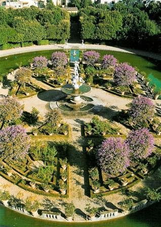
POSTALES www.triangle.cat * Foto: © Pere Vivas
ES-287881, sent by Jordi
Somorrostro Beach, stretching 522 metres between the Gas Jetty and the Marina Pier, was originally where the Somorrostro shanty town was located, housing 15,000 people in poverty-stricken conditions.
Nowadays there is no sign of its precarious past and the beach is one of the most popular and emblematic beaches along the coastline. - in: http://www.mydestination.com/barcelona/6183333/barcelona-beaches-somorrostro-beach

 TRIANGLE POSTALES www.triangle.cat * Foto: Biel Puig
The basilica of Santa Maria del Mar in Barcelona, also known as the “cathedral of La Ribera”, is one of the most perfect examples of Gothic style architecture due to its harmonious proportions and the serenity of the ensemble. 
In the Middle Ages, the long periods of time it took to build a church – often more than a century – usually involved changes in architectural style. Santa Maria del Mar in Barcelona is an exception. It was built in just 55 years, from 1329 to 1384, and is the only surviving church in the pure Catalan Gothic style. Its structure comprises three naves of the same height, underpinned by very tall columns set 13 metres apart, a distance unsurpassed by any other existing medieval building. This gives the impression of sublime width, height and airiness, as if gravity had been reversed and pulled the immense blocks of stone upwards. The many stained-glass windows of the church of Santa Maria del Mar play an important role in giving this impression.
The window of the Ascension, in the chapel of Santa Maria, and the Lavabo in the chapel of Sant Rafael, as well as the great rose window are some of the most outstanding examples of the church. The latter was destroyed during the earthquake that shook Barcelona in 1428, and remade in the mid-15th century. If you look at the floor you’ll see private tombs and those of Barcelona’s medieval guilds and brotherhoods. The basilica of Santa Maria del Mar, which was designed by Berenguer de Montagut, was the place of worship for the shipwrights and merchants of Gothic Barcelona. - in: http://www.barcelonaturisme.com/Santa-Maria-del-Mar/_3Ngb8YjSpL3U56ScBHOWcxpDev_Vr2xe7rhAgUa92B0

TRIANGLE POSTALES * Foto © Pere Vivas
Some facts about La Sagrada Familia.
* Temple: The correct title of the Church is the Temple La Sagrada Familia. Temple refers to the fact that it was built entirely by donations.
* Death of Antoni Gaudi: The architect died by being hit by a tram in 1926. He was buried in the Capilla del Carmen Crypt inside the Sagrada Familia.
* Most Visited: The Sagrada Familia in Barcelona opens its doors to about 3 million visitors per year, making it the most visited monument in Spain.
* God’s Work: Gaudi designed the Sagrada Familia so that the basilica did not exceed 984 feet above sea level. He did this because he believes that the highest point in the city should be a natural god made structure, that being the mountain of Montjuic, which is 984 feet above sea level.
* Towers:  At the completion of the church, there should be 18 towers: one for each of the 12 apostles, one for each of the 8 evangelists, one representing the Virgin Mary, and the highest tower in honor of Jesus.
* The Project was not started by Gaudi: The construction of the Sagrada Familia began in 1883 under the direction of architect Francisco de Paula del Villar y Lozano. His vision was for a neo-Gothic church.  In 1883, Gaudi took over the project and changed the direction of design completely.
* Straight Lines: There are not straight lines or angles in the Sagrada Familia. Gaudi was inspired by the curves and flow of nature.
* Shape Tree: The columns supporting the inside of church are thought to act like trees. At the base you have a simple pillar but the pillar eventually starts to branch off multiple times in a mathematical progression.
* Facade: One of the facades of the church is called the ¨cradle of life¨(Façade de la Natividad). It was the only one built while Gaudi was alive.
Gaudi´s masterpiece is not only a symbol of the Holy Family but is perhaps the greatest symbol of Barcelona with its remarkable beauty and impressive grandeur. - in: http://www.world-insider.com/top-10-interesting-facts-of-the-sagrada-familia-in-barcelona/

Wednesday, May 14, 2014

Canadian UNESCO WHS

Recentely the canadian postal service issued a set of 5 cards featuring magnificent vistas of 5 Canada’s UNESCO World Heritage sites. Émilie was offering these sets and I asked her to send me 3 of the cards, Nahanni National Park, Miguasha National Park and Joggins Fossil Cliffs, on the list since 1978, 1999, 2008. Here they are.  

 Photo: Parks Canada / Parcs Canada © 2014 Canada Post
Located along the South Nahanni River, one of the most spectacular wild rivers in North America, this park contains deep canyons and huge waterfalls, as well as a unique limestone cave system. The park is also home to animals of the boreal forest, such as wolves, grizzly bears and caribou. Dall's sheep and mountain goats are found in the park's alpine environment. - in: http://whc.unesco.org/en/list/24

  Photo: Parc National de Miguasha / Miguasha National Park SÉPAC © 2014 Canada Post
The palaeontological site of Miguasha National Park, in south-eastern Quebec on the southern coast of the Gaspé peninsula, is considered to be the world's most outstanding illustration of the Devonian Period known as the 'Age of Fishes'. Dating from 370 million years ago, the Upper Devonian Escuminac Formation represented here contains five of the six fossil fish groups associated with this period. Its significance stems from the discovery there of the highest number and best-preserved fossil specimens of the lobe-finned fishes that gave rise to the first four-legged, air-breathing terrestrial vertebrates – the tetrapods. - in: http://whc.unesco.org/en/list/686

 Photo: Joggins Fossil Institute © 2014 Canada Post
The Joggins Fossil Cliffs, a 689 ha palaeontological site along the coast of Nova Scotia (eastern Canada), have been described as the “coal age Galápagos” due to their wealth of fossils from the Carboniferous period (354 to 290 million years ago). The rocks of this site are considered to be iconic for this period of the history of Earth and are the world’s thickest and most comprehensive record of the Pennsylvanian strata (dating back 318 to 303 million years) with the most complete known fossil record of terrestrial life from that time. These include the remains and tracks of very early animals and the rainforest in which they lived, left in situ, intact and undisturbed. With its 14.7 km of sea cliffs, low bluffs, rock platforms and beach, the site groups remains of three ecosystems: estuarine bay, floodplain rainforest and fire prone forested alluvial plain with freshwater pools. It offers the richest assemblage known of the fossil life in these three ecosystems with 96 genera and 148 species of fossils and 20 footprint groups. The site is listed as containing outstanding examples representing major stages in the history of Earth. - in: http://whc.unesco.org/en/list/1285

Sunday, May 11, 2014

CA-430195

On the back of the card: This mountain park features alpine lakes, subalpine meadows, rugged peaks and historic century-old silver mine sites. Here we see Kane Peak and Glaciwer View Peak from the Silver Spray area.

Photo by Don Lyon
CA-430195, sent by Sue.
Kokanee Glacier Provincial Park is one of the oldest provincial parks in British Columbia, established in 1922. The park has an area of 320.35 km2 (123.69 sq mi) and is located in the Selkirk Mountains in the West Kootenays region of BC. The park has three glaciers (Kokanee, Caribou, and Woodbury) that feed over 30 alpine lakes which are the headwaters of many creeks. - in: wikipedia

Saturday, May 10, 2014

US-2733208

Lake Erie lighthouses.

 Photos by John Penrod
US-2733208, sent by Beckys.
For over a century, the lighthouses of Lake Erie have guided ships into the many North coast harbors. Today, many of these gracious structures have been restored and still stand along the shore, from Sandusky to Ashtabula. Some are in ruins, yet somehow picturesque; others welcome visitors with museums and visitors' centers. - in: http://cleveland.about.com/od/clevelandattractions/ss/lighthouses.htm
Clockwise as shown: Presque Island, Erie Land, Buffallo Main, Marblehead, Dunkirk, Conneaut, Cleveland and Barcelona. 

Tuesday, May 6, 2014

JP-498670

Two Kyoto's maiko girls enjoying a tea cerimony in a local garden. 
Maiko is an apprentice geisha in western Japan, especially Kyoto. Their jobs consist of performing songs, dances, and playing the shamisen (three-stringed Japanese instrument) for visitors during feasts. Maiko are usually aged 15 to 20 years old and become geisha after learning how to dance (a kind of Japanese traditional dance), play the shamisen, and learning Kyō-kotoba (dialect of Kyoto), regardless of their origins.

JP-498670, sent by Yuka.
Maiko originated from women who served green tea and dango (Japanese dumpling made from rice flour) to people who visited the Kitano Tenman-gū or Yasaka Shrine (these are the two of the famous shrines in Kyoto) at teahouses in the temple town about 300 years ago.
At first, women served only green tea and dango, but they gradually started to perform songs and dances for visitors.
In the morning, maiko take lessons to polish their performances. At night, they go out to work. They are usually given the opportunity to eat at high-class Japanese-style restaurants or stay in Japanese-style hotels. They perform dances, songs, play the shamisen, and serve visitors with sake. Recently, their jobs have expanded to include visiting nursing institutions or hospitals. Some maiko are also dispatched overseas. - in: wikipedia

Monday, May 5, 2014

HK-232001

Lion Rock, or less formally Lion Rock Hill, is a famous hill in Hong Kong. It is located between Kowloon Tong in Kowloon and Tai Wai in the New Territories, and is 495 metres high. The peak consists of granite covered sparsely by shrubs.
Lion Rock is famous for its shape and is visible from various places in Kowloon; its resemblance to a crouching lion is most striking from the Choi Hung and San Po Kong areas in East Kowloon. 
rock provides a beautiful view of the city and Hong Kong Island in the distance. - in: wikipedia

HK-232001, sent by Angus.
On the back of the card: Among all the mountains of Hong Kong, the profile of Lion Rock (495 m) looks most like an animal. Just like a lion, this massive rock towers regally above the Kowloon Hills. It is clearly visible from many locations across the territory. 
To the people of Hong Kong, the Lion Rock has always been very special, for it seems to offer protection and shelter for those under its feet. Perhaps its because Lion Rock is so close to the city. Its boulder strewn green ravines are popular sites for hiking and family picnics. 

CN-1272038

A card from Beijing, China, showing the Central Axis, the best preserved core area of the old city of Beijing. 
The old city of Beijing was first built in the Yuan Dynasty (mid-13th Century, formerly known as "Dadu"), and further developed and perfected in the Ming and Qing Dynasties (early 14th Century to early 20th Century). With eight hundred years’ history of urban development, it is now the largest imperial capital city still existing in China and a classic model of ancient Chinese urban planning. As an outstanding example of feudal China’s capital, the old city of Beijing enjoys a prominent position in the world history of urban planning and development.

CN-1272038, sent by Tony.
The Central Axis of Beijing is 7.8 kilometers long starting in the south of the city from the Yongding Gate, running across the Zhengyang Gate, Tian'anmen Square, the Forbidden City, the Jingshan Hill, and ending with the Drum Tower and Bell Tower in the north. Most of the essential buildings in the old city of Beijing are constructed along the axis. The Central Axis ingeniously organizes the imperial palaces, the imperial city, temples and altars, markets, streets from feudal times and the Tian’anmen square complex built after the founding of the People’s Republic of China in 1949. As the most representative and important section of the old city of Beijing, it is the core of old Beijing’s spatial pattern and demonstrates the magnificent spatial order of the urban space. - in: http://whc.unesco.org/en/tentativelists/5802/

Saturday, May 3, 2014

Mt. of Olives - Jerusalem

This was another bad mail week. Mail has been really slow, i didn't get many cards this week, i think i've only got one and my sent mail is travelling for way too long! Getting and sending mail used to be so much more exciting, i really miss those days. 

A few days ago Ania, from Poland, requested me a card and in return she sent me this Mt. of the Olives card. 

Photographed by Garo Nalbandian
The Mount of Olives is a mountain ridge east of and adjacent to the Jerusalem's Old City. It is named for the olive groves that once covered its slopes. The southern part of the Mount was the necropolis of the ancient Judean kingdom. The Mount has been used as a Jewish cemetery for over 3,000 years, and holds approximately 150,000 graves, making it central in the tradition of Jewish cemeteries. 
Several key events in the life of Jesus as related in the Gospels took place on the Mount of Olives, and in the Book of Acts it is described as the place from which Jesus ascended to heaven. Because of its association with both Jesus and Mary, the Mount has been a site of Christian worship since ancient times and is today a major site of Christian pilgrimage for Orthodox, Catholic and Protestant Christians. - in: wikipedia